
Wellington Monument - Sep 2026
| Wellington Monument - Sep 2026 |
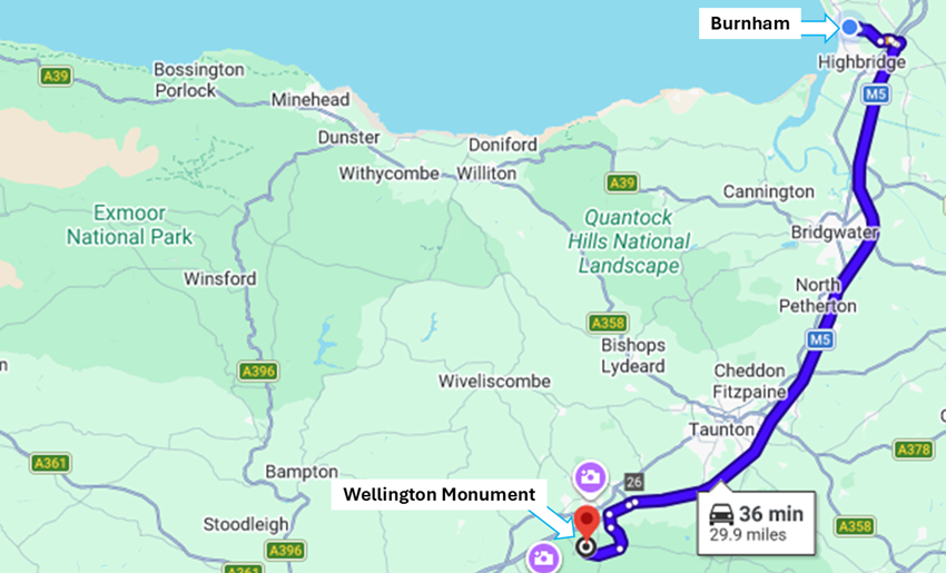
| Wellington Monument was built to honour the Duke of Wellington after he did such a good job at Waterloo in 1815. It couldn't be just your average monument here at the edge of the Blackdown Hills on the border between Somerset and Devon. The monument had to be special so they built the tallest three-sided obelisk in the world. Liz who knows about most events in the area, told us of this one-day opportunity to climb the 232 steps free of charge. Just 40 minutes down the road from us we found the handy car park, and Liz paid for parking with her National Trust membership. Thank you, Liz! |
|
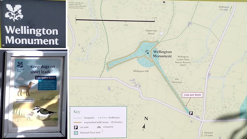
| The walk from the car park to the monument was straight and flat. Several other people arrived to climb the monument - or just to walk in the park with their dogs. Dogs had to be kept on short leads due to wildlife, but many visitors didn't seem to know this. |
|
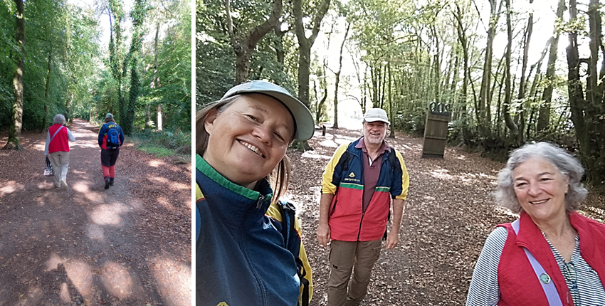
| We just enjoyed the leisurely walk on a beautiful day. |
|
|
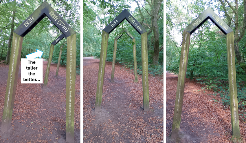
The first version of the monument was built in 1829 by Thomas Lee Junior. He
ran out of money, and it was only 37 metres high with 190 steps.
In 1852 the Duke of Wellington died, and people thought we'd better finish this monument thing. So in 1854 the tower was extended to 52 metres high. In 1892 they added another metre with a lightning conductor on top. The tower was now 53 metres high with 232 internal steps. |
|
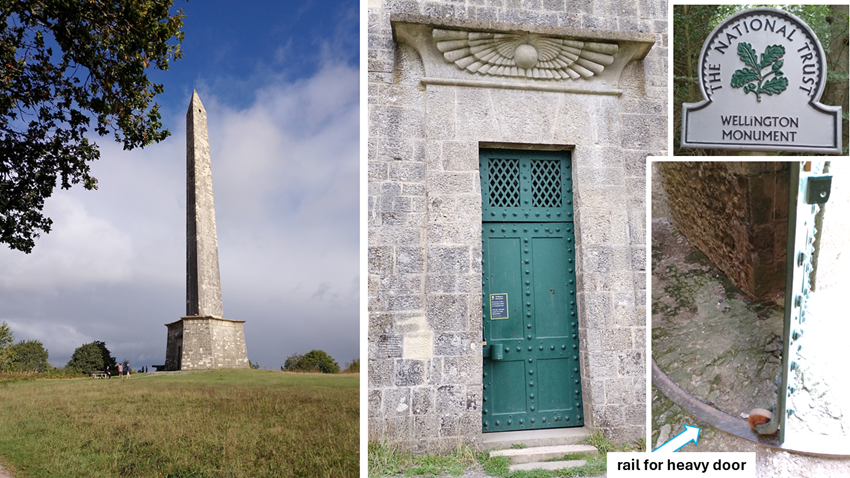
| The monument is indeed very tall and impressive as you get closer and closer to it. The door we had to walk through is huge and heavy and has its own little rail system! |
|
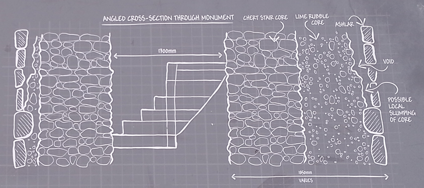
| The monument has been maintained and fixed over the years. Here is a cross section of it showing the spiral staircase being 1.3 metre wide. Hmmm tight to climb up 232 steps. |
|
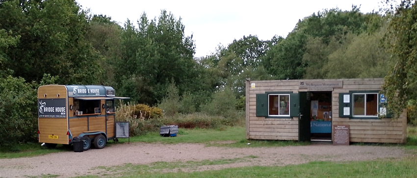
| The site is managed by National Trust volunteers. They let us know that there was a one- to two-hour wait for our turn. It is so narrow inside the staircase that they only allow 3 people at a time. Smart. There was a mobile coffee shop, but we had brought our own picnic and tea-making facilities. |
|
|
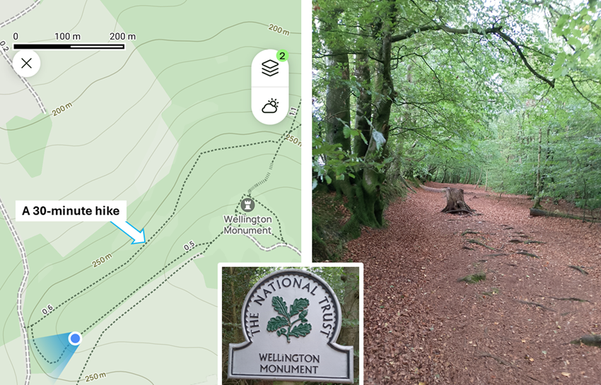
While waiting for our turn, the lady in the office suggested we hike
a circular path near the monument. We found the trail on our hiking
App so we walked with confidence through the forest. It was an easy
walk, and we took about 30 minutes including some rather steep stairs
at the end.
One should question whether it was a good idea to add these extra sets of stairs to our day when we knew there was 232 steps to do in the monument. Next time we may not do the additional hike. |
|
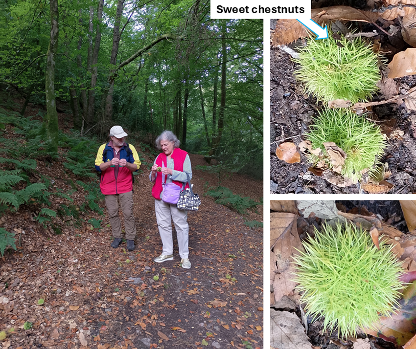
| Along the way, Rob and Liz were inspecting sweet chestnuts. Liz was brave/careful enough to pick up one of them for closer inspection. Their spikes are really sharp! |
|
|
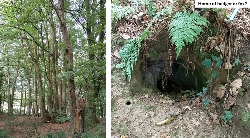
On the left below, we saw many beech trees being stood very close together.
We were pondering why that would be so. The soil also seemed to be very
shallow in this area. While it looks like the trees had been coppiced
- sending new shoots up near the original trunk - it seems unlikely in
an unmanaged forest. The trees look 150-200 years old so they would have been
very young at the time of the monument building. If trees could talk, eh?
On the right below: We came across this very visible - not hidden at all - hole in the ground. Best guess is the home of a badger or fox. This could have been settled by sniffing the entrance to the hole. Badgers smell like damp earth while foxes have a sharp skunky odour. We were NOT going to try that trick and choose to live in ignorance. |
|
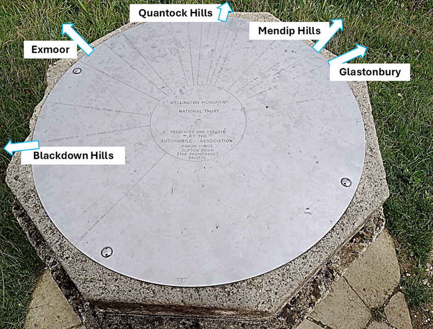
| A marker installed near the monument helped orient ourselves geographically, and also prepare us for the view we would get at the top. Exmoor to the left of us, Mendips to the right of us,... Liz also pointed out that the marker could have been more helpful in labelling the locations relative to each other based on how far away they were. We like that idea - adding a 3rd dimension to the information. |
|
|
We waited patiently until the previous visitors came down from the tower.
Sadly the clouds were appearing (as they would with Rob and Hild's luck)
but we hoped the view would be good by the time we climbed to the top.
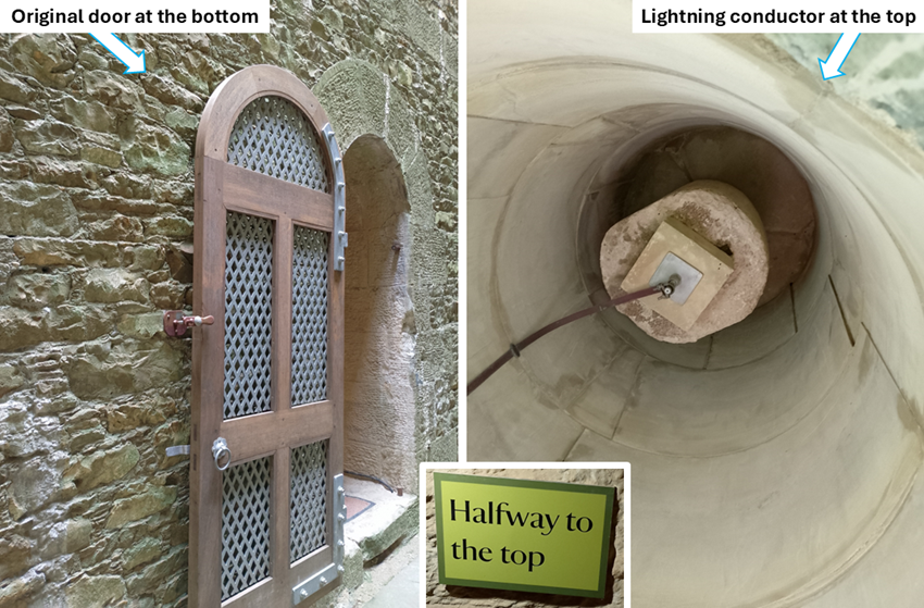
We got our snazzy hard hats and emergency walkie-talkie when it was our turn. The climb started at the nice door at the bottom and ended at the lightning conductor at the top. At the half-way mark we decided we were all able to continue. It helped that the staircase was well-lit even if there were no windows until we reached the top. |
|
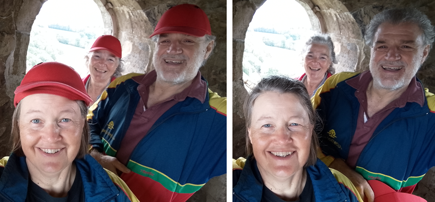
| And here we are - happy to have reached the top. With hats and without hats. It was a tight fit, so limiting each party to 3 people was perfect. |
|
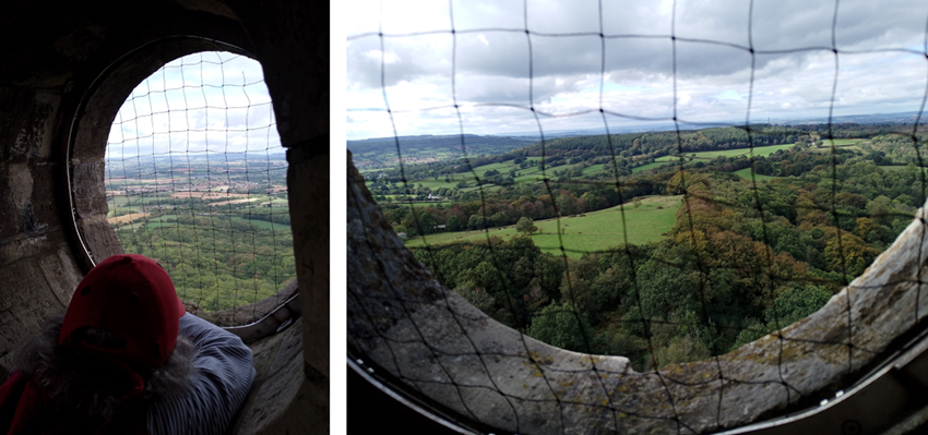
| The windows made it very nice and airy at the top, and the netting made you (and your phone/camera) feel safe. |
|
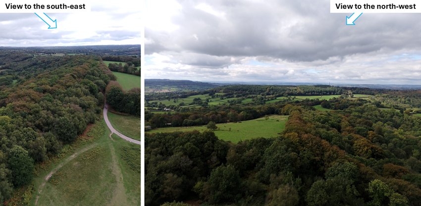
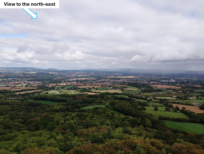
| It was hard to determine which direction we were looking out through the three windows. One pointed in a south-east direction towards the car park and the Blackdown Hills. One pointed to the north-west and what we think has Exmoor on the left and Quantock Hills on the right. The last window faced north-east with the Mendips in the distance. |
|
|
Sidenote: Earlier on, the guide admitted that there was limited help to be had if we
called them on the walkie-talkie from the top. Somehow, we would have to make
our way down anyway. We discussed options such as abseiling, base jumping,
and a zip-line. Today our only option was on foot.
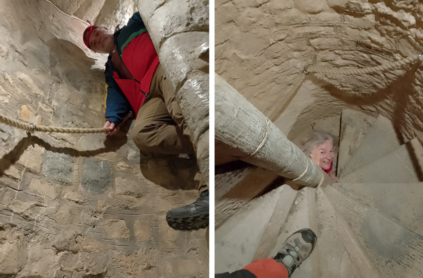
The walk down was much easier, and we felt ready to take photos in the narrow staircase. As you can see, very nice and bright. Didn't need a flash on the camera either. The rope was very nice to hold on to because the steps were quite narrow compared to our giant feet! |
|
| We (Liz and Hild) were completely turned around and dizzy by the time we got to the bottom. The conversation in this video was not worth sharing, so I've removed the voices (to protect the guilty/silly). |
|
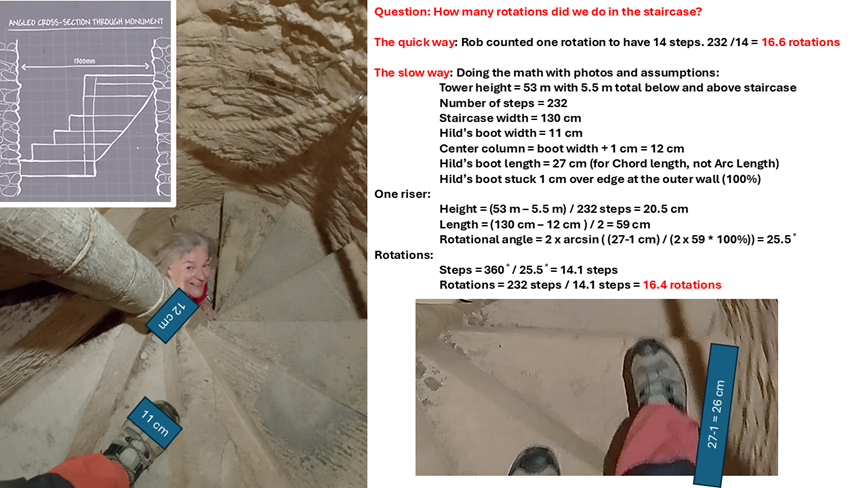
Needless to say, Rob kept busy "doing the math" on the way down.
He counted 14 steps for a full 360 circle meaning 16.6 rotations over 232 steps.
He wasn't confident that this was correct.
The guide didn't know. Other visitors rolled their eyes and backed away from us...
We have since done the math to work it out: 53 metres high, less 1 metre for the entry at the bottom and less 4.5 metres at the top for the roof etc. That makes for 47.5 metres divided by 232 steps = 20.5 cm per riser. We measured the dimensions of the risers based on photos and Hild's boot. Not a standard unit of measurement! This gave us a rotational angle of 25.5, which means 14.1 steps in a full circle, and finally 16.4 rotations. We find fun in the oddest places! And we learnt to just trust Rob in the future... |
|
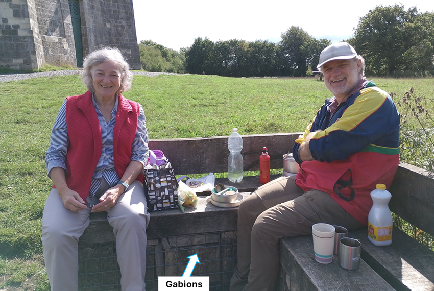
| Back safely at ground level it was time to retrieve our bags from the park office and get our picnic going. The conservation project has replaced 1508 stones in the monument. Some of the stones have been secured in gabions and converted into benches - handy for picnic. |
|
|
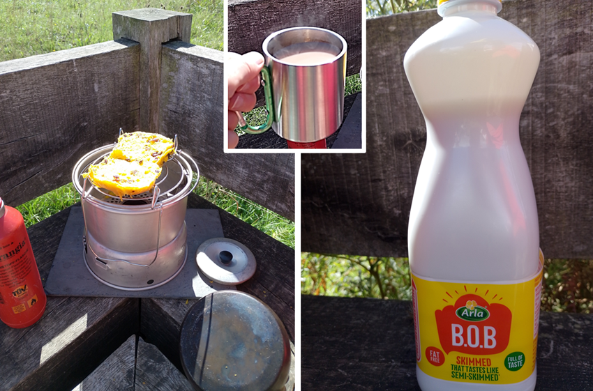
Liz had brought various delicious baked goods for our picnic including
saffron buns that we toasted on the camp stove. Rob made tea with the
B.O.B milk purchased at the service station in Bridgwater (because Hild
forgot the flask at home). Liz taught us that "B.O.B" means "Best of Both".
It worked for tea at least.
The sun came out for our picnic. A lovely place to bring visitors for a day out! |
|
Sep 2026