
Rob-n-Hild Take the High Road!
Click links to jump to specific days:
Start | Nerdy
| Stranger Things
| Stairs Stairs Stairs
|
|||||||||||||||||||||||||||||||||||||||||||||||||||||||||||||||
|
Grasmere Dig-Dig-Dig route: 5.6 km in 1:20 hours while ascending 300 metres to a max altitude of 350 metres. Feel the Force route: 8 km in 2:50 hours while ascending 300 metres to a max altitude of 290 metres. |
|||||||||||||||||||||||||||||||||||||||||||||||||||||||||||||||
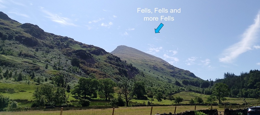
| Today we wanted to explore the Lake District. That could take years, so we chose Grasmere as our starting point. Rob had identified a couple of hikes that also came with free audio guides. Very handy. On our way over from the campsite we enjoyed the increasing number of steep fells, which they call these hills here. It sounds alot like Norwegian "fjell" which is our word for mountain. | |||||||||||||||||||||||||||||||||||||||||||||||||||||||||||||||
|
|||||||||||||||||||||||||||||||||||||||||||||||||||||||||||||||
|
Rob managed to secure the last but two parking spaces in downtown Grasmere.
Percy was happy there all day. Easy to pay for parking with an App that we already
had. As our schedule developed today, we were able to add more time using the App too.
Many more people were parked along the roads - presumably because they
preferred not to pay the parking charge.
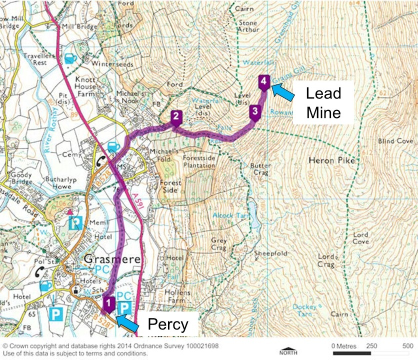
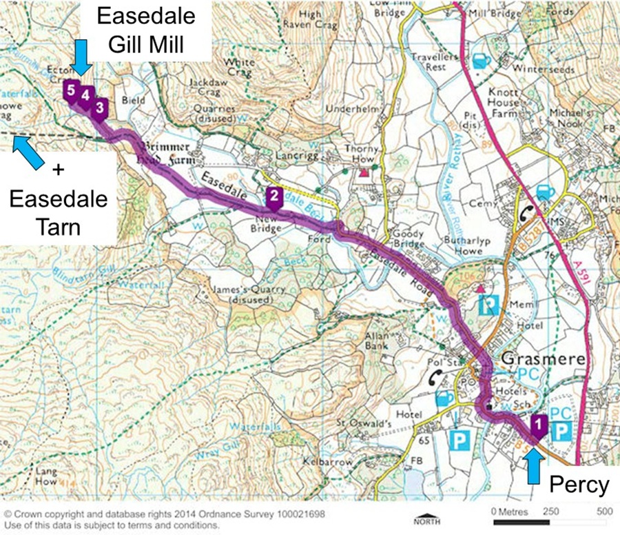
We used the free 'Dig Dig Dig' audio trail to guide us along Greenhead Gill and learn about the geological riches of the Lake District. We hiked 5.6 km in 1:20 hours while ascending 300 metres to a max altitude of 350 metres. |
|||||||||||||||||||||||||||||||||||||||||||||||||||||||||||||||
|
|||||||||||||||||||||||||||||||||||||||||||||||||||||||||||||||
| As shown on this map, it really wasn't easy to find the remnants of this lead mine from the 1500s. It was built by Germans so we figured it would still be here - alas no. | |||||||||||||||||||||||||||||||||||||||||||||||||||||||||||||||
|
|||||||||||||||||||||||||||||||||||||||||||||||||||||||||||||||
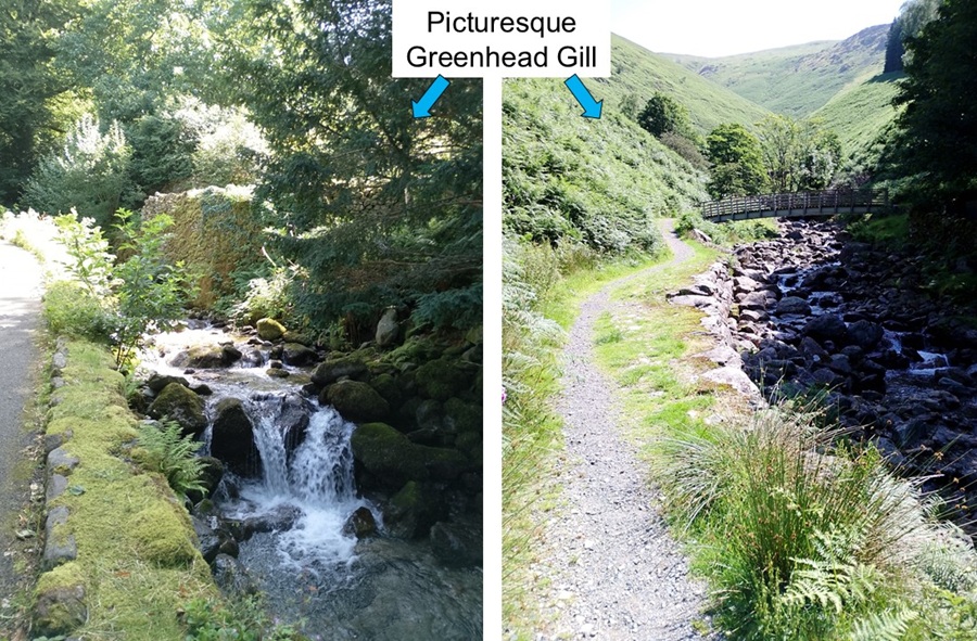
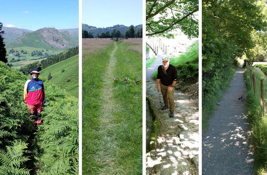
| The trail up to the mine took us along the picturesque Greenhead Gill. First we had paved roads and then it developed into a nice gravel track. It was a steep climb. | |||||||||||||||||||||||||||||||||||||||||||||||||||||||||||||||
|
|||||||||||||||||||||||||||||||||||||||||||||||||||||||||||||||
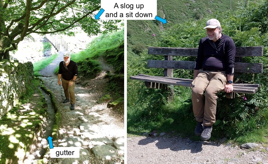
| After crossing the gill, we found stone stairs for Rob to climb. They weren't the worst we've used, and there was an organised gutter for water to run down and prevent flood/mud. Halfway up the hill we took a break on a very tall bench! Our legs were dangling like we were children again. More information on the audio guide also informed us that they used to (still do?) take water from this gill all the way to Manchester. The aqueduct is still there but the amount of water in the gill does not look like enough to transport anywhere. | |||||||||||||||||||||||||||||||||||||||||||||||||||||||||||||||
|
|||||||||||||||||||||||||||||||||||||||||||||||||||||||||||||||
|
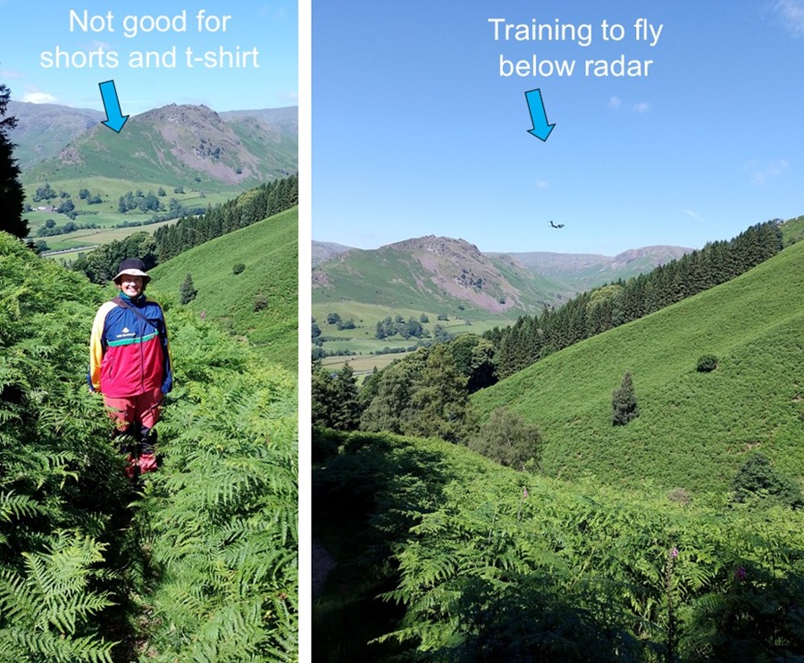
The onwards trail was hard to find because it was completely overgrown
by bracken and other vegetation. We had chosen wisely by not wearing
shorts and t-shirt today. We didn't meet any people on this trail - maybe
because it is overgrown or because no one else wants to learn about ancient
mining?
During our hike several military aircraft flew through the valley. They flew very low and were clearly training to fly below radar. |
|||||||||||||||||||||||||||||||||||||||||||||||||||||||||||||||
|
|||||||||||||||||||||||||||||||||||||||||||||||||||||||||||||||
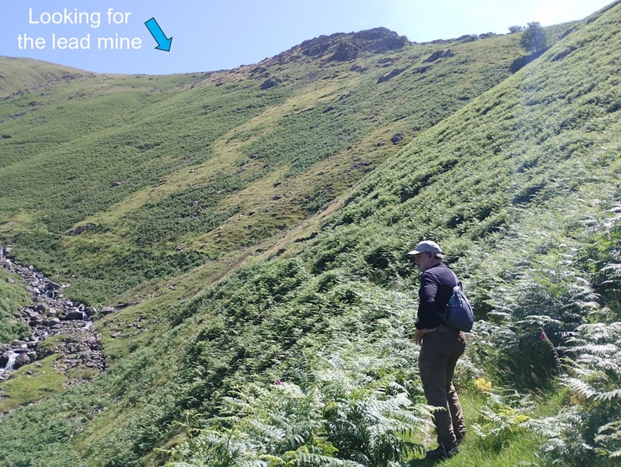
| The audio guide was trying to explain where to look for the remnants of the lead mine. It was also telling stories about how the locals didn't get along with the Germans. There was worker's unrest and even murder. Now there was just bracken and sheep. Way up on the top of the fells we could see other hikers who had chosen different trails to us. | |||||||||||||||||||||||||||||||||||||||||||||||||||||||||||||||
|
|||||||||||||||||||||||||||||||||||||||||||||||||||||||||||||||
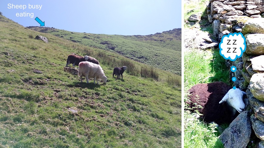
| We walked carefully so as not to scare the many sheep who were grazing along the gill. They weren't very scared of us, but we were careful anyway. One particular sheep was fast asleep behind some rocks and didn't notice our arrival. She was a bit startled when she woke up and stared into Rob's camera. Who wouldn't have tried to run away then?! | |||||||||||||||||||||||||||||||||||||||||||||||||||||||||||||||
|
|||||||||||||||||||||||||||||||||||||||||||||||||||||||||||||||
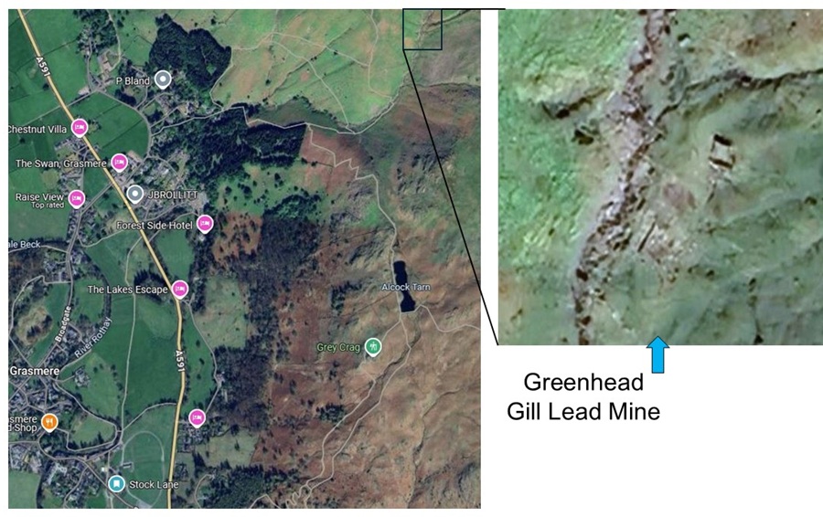
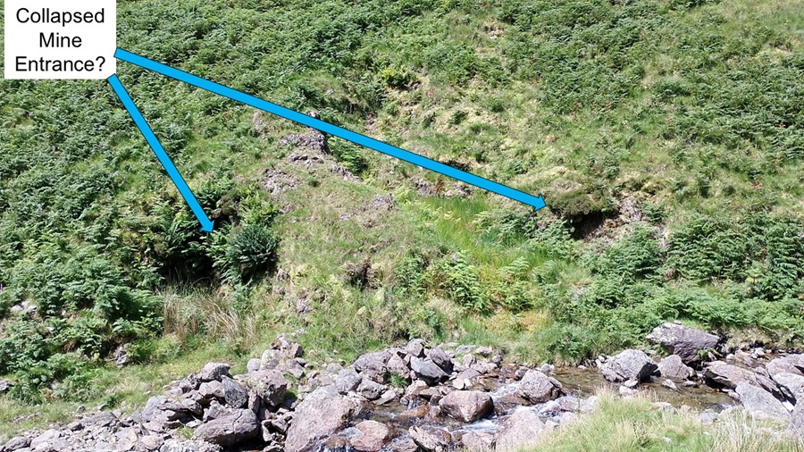
| We listened to the audio guide several times and came to the conclusion that these holes are where the mine entrances used to be. | |||||||||||||||||||||||||||||||||||||||||||||||||||||||||||||||
|
|||||||||||||||||||||||||||||||||||||||||||||||||||||||||||||||
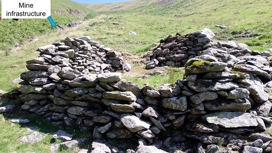
| Other stone structures were part of the mill as well as bothys and storage facilities. | |||||||||||||||||||||||||||||||||||||||||||||||||||||||||||||||
|
|||||||||||||||||||||||||||||||||||||||||||||||||||||||||||||||
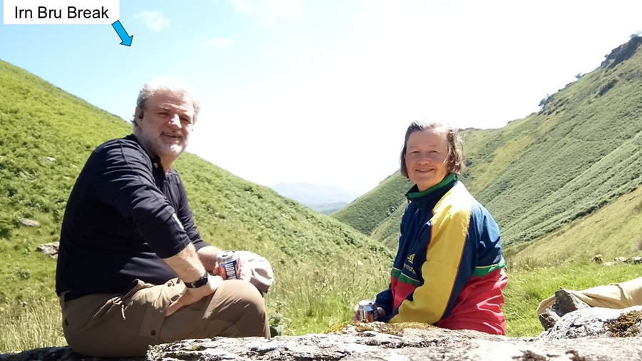
| We enjoyed the audio guide and the view - while having an "Irn Bru" break. | |||||||||||||||||||||||||||||||||||||||||||||||||||||||||||||||
|
|||||||||||||||||||||||||||||||||||||||||||||||||||||||||||||||
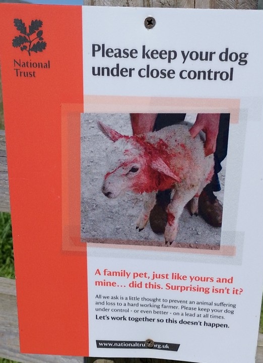
| The route back down the hill was much easier - and obviously not more to see. At the bottom, we did take a short cut across fields using Public Foot Paths. The usual warning signs about keeping your dog on a lead were somewhat more graphic than normal: blood gushing from little lamb. Hopefully people do the right thing. | |||||||||||||||||||||||||||||||||||||||||||||||||||||||||||||||
|
|||||||||||||||||||||||||||||||||||||||||||||||||||||||||||||||
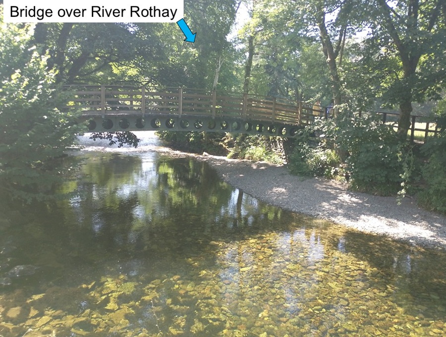
| When we got back to the bridge over River Rothay, we knew we were nearly back with Percy. Time for lunch and a well-deserved rest. | |||||||||||||||||||||||||||||||||||||||||||||||||||||||||||||||
|
|||||||||||||||||||||||||||||||||||||||||||||||||||||||||||||||
| Today it was wise to have chosen hiking boots. There was no bog and mud. The trails varied from bracken-covered grass and gravel to grass trails across fields to stone steps and gravel tracks. | |||||||||||||||||||||||||||||||||||||||||||||||||||||||||||||||
|
|||||||||||||||||||||||||||||||||||||||||||||||||||||||||||||||
|
After the usual picnic lunch in the back of Percy, it was time for our
second hike in Grasmere. Starting from the same car park we just extended
our parking fee and set off.
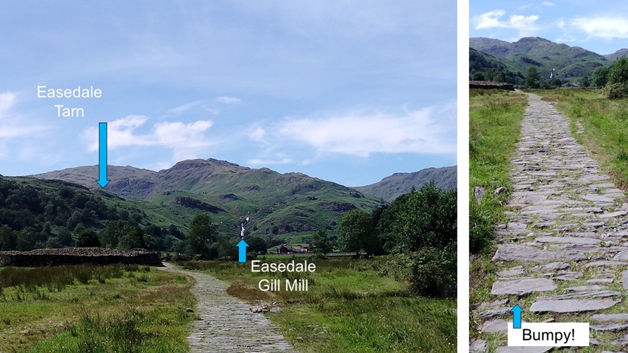
We used the free 'Feel the Force' audio trail to guide us to Easedale to learn about how water power drove the wheels of industry. Little did we know that we'd also do a detour to Easedale Tarn because everyone else seemed to be doing that. In the end, we hiked 8 km in 2:50 hours while ascending 300 metres to a max altitude of 290 metres. |
|||||||||||||||||||||||||||||||||||||||||||||||||||||||||||||||
|
|||||||||||||||||||||||||||||||||||||||||||||||||||||||||||||||
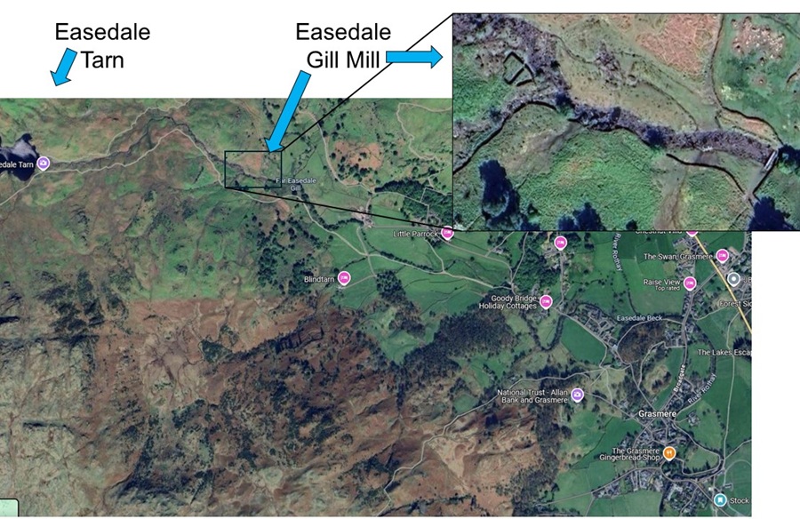
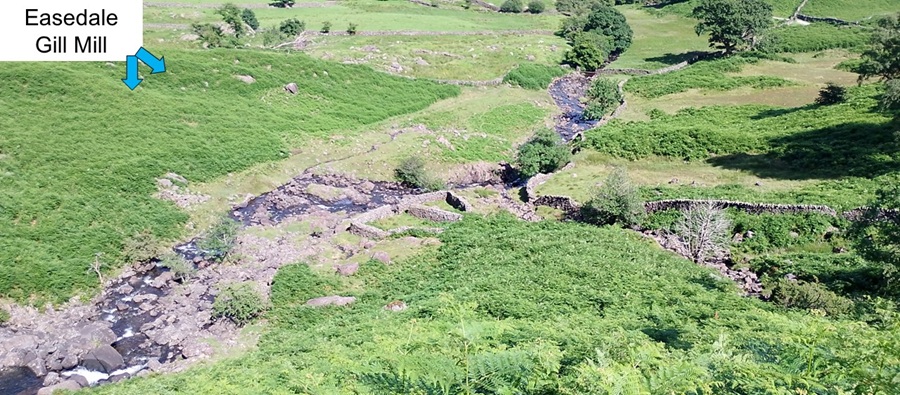
| It wasn't easy to determine which bit of stone infrastructure was the Easdale Gill Mill, but satellite photo and the audio guide helped as much as they could. | |||||||||||||||||||||||||||||||||||||||||||||||||||||||||||||||
|
|||||||||||||||||||||||||||||||||||||||||||||||||||||||||||||||
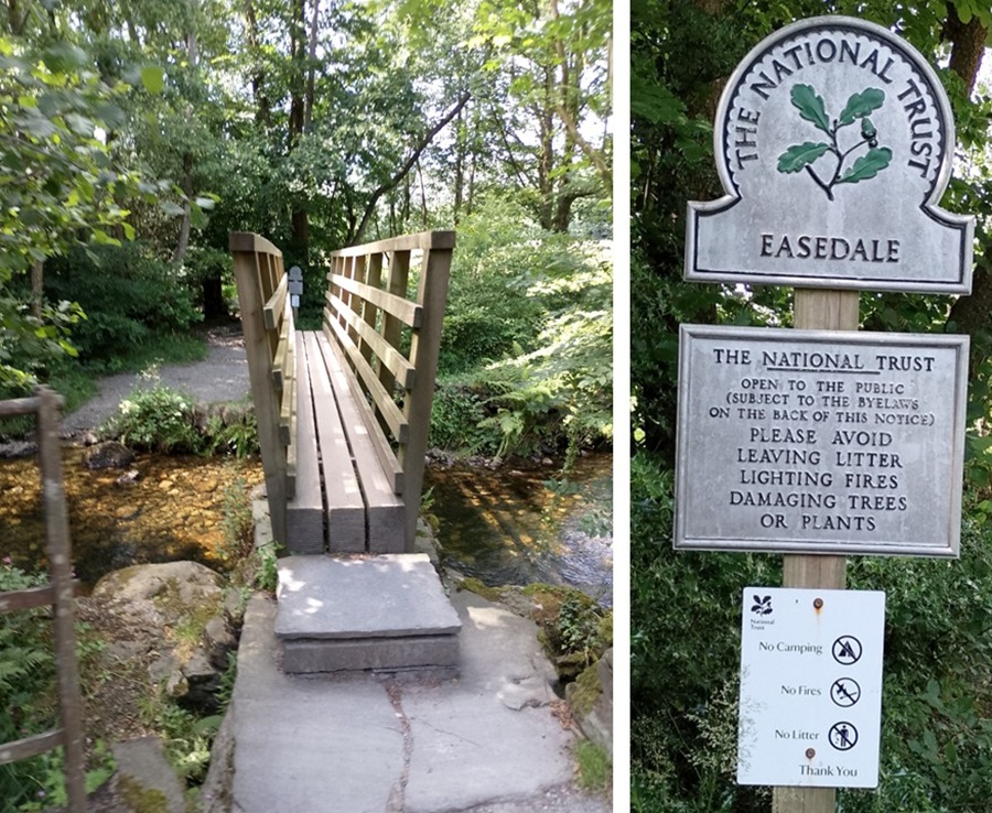
| Leaving Grasmere we arrived at our trail while crossing a very very narrow bridge. The first hint that this trail is not accessible by wheelchair or with pram. | |||||||||||||||||||||||||||||||||||||||||||||||||||||||||||||||
|
|||||||||||||||||||||||||||||||||||||||||||||||||||||||||||||||
| The trail we were following was an ancient pack animal trail. Poor animals - the path was very wobbly underfoot. It made it impossible or at least very difficult to access in a wheelchair, in a pram, and thankfully in flip-flops and crocs. It didn't stop people trying though... | |||||||||||||||||||||||||||||||||||||||||||||||||||||||||||||||
|
|||||||||||||||||||||||||||||||||||||||||||||||||||||||||||||||
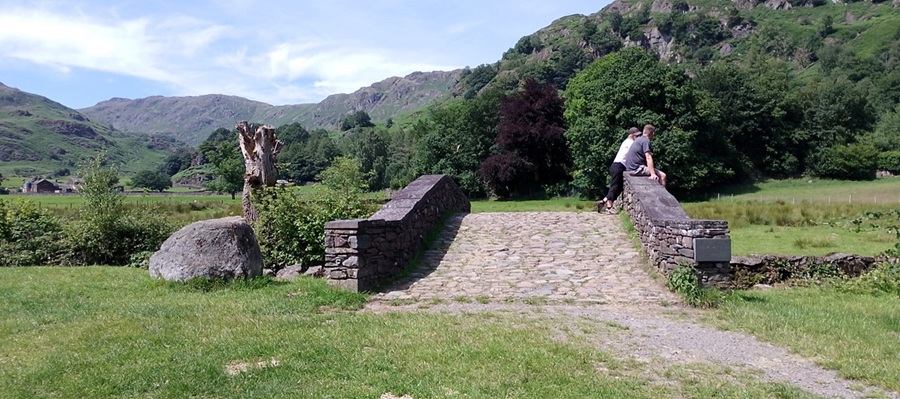
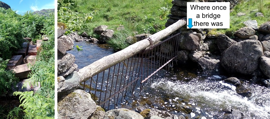
| Part of the audio guide let us sit and enjoy the look of this bridge (that's not us in the photo) while learning how local people would band together to keep bridges (wood and stone) open all year round. That was not easy or cheap. | |||||||||||||||||||||||||||||||||||||||||||||||||||||||||||||||
|
|||||||||||||||||||||||||||||||||||||||||||||||||||||||||||||||
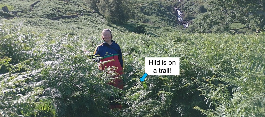
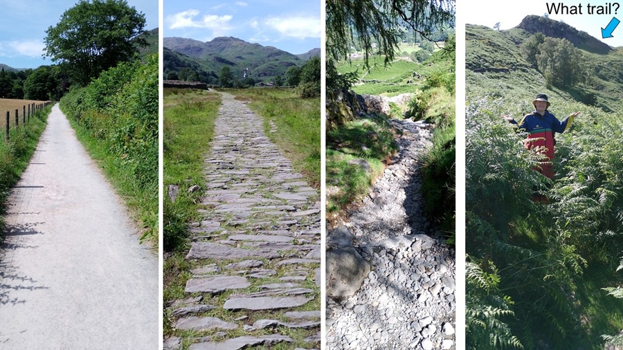
| Again we had to hunt around to find the path going through out-of-control bracken. Easy for us, not so easy for those we met who had chosen shorts and t-shirt. | |||||||||||||||||||||||||||||||||||||||||||||||||||||||||||||||
|
|||||||||||||||||||||||||||||||||||||||||||||||||||||||||||||||
| At the site of the Easedale Gill Mill we learnt that the wooden bridge that was there is no more. Hidden in the bracken we also found wooden logs chopped up into pieces. We are not sure if this was part of a plan or just vandalism. | |||||||||||||||||||||||||||||||||||||||||||||||||||||||||||||||
|
|||||||||||||||||||||||||||||||||||||||||||||||||||||||||||||||
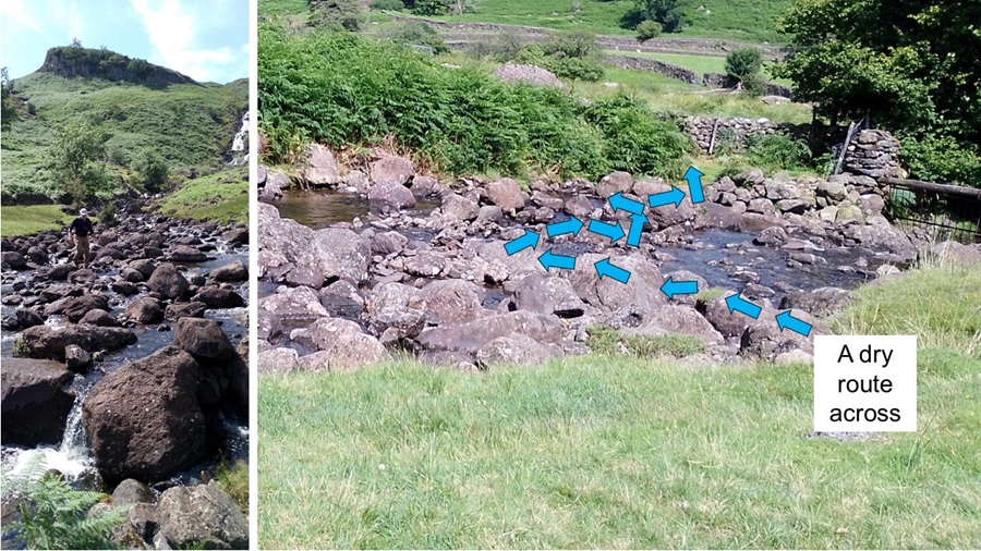
| While we listened to our audio guide other walkers were struggling to cross the gill. They ended up with very wet socks! Hild plotted a different and more zig-zaggy route across. Not a wet sock or shoe in sight. It did require more walking on bracken-covered trails, so that may be what the shorts-clad hikers chose: wet socks over bracken. | |||||||||||||||||||||||||||||||||||||||||||||||||||||||||||||||
|
|||||||||||||||||||||||||||||||||||||||||||||||||||||||||||||||
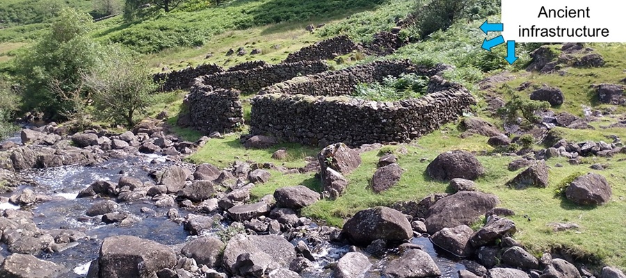
| From to the audio guide we learnt about the process they used to prepare wool for spinning. Lots of water and labor was needed, and this is where it happened. The stone structures in the area were not necessarily from the original mill because it was probably made from wood. One of the stone structures was a sheep dip even. | |||||||||||||||||||||||||||||||||||||||||||||||||||||||||||||||
|
|||||||||||||||||||||||||||||||||||||||||||||||||||||||||||||||
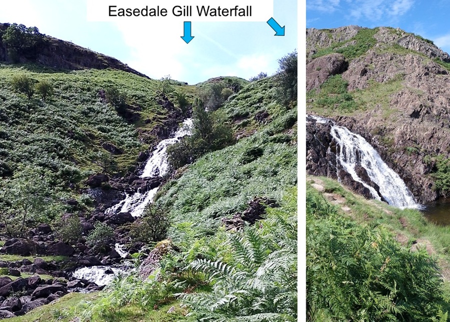
| The reason for the mill being here was because of easy access to plenty of water in Easdale Gill. The waterfall is now just pretty to look at and has several waterholes where other hikers were taking a dip. Mental note: don't drink the water downstream. | |||||||||||||||||||||||||||||||||||||||||||||||||||||||||||||||
|
|||||||||||||||||||||||||||||||||||||||||||||||||||||||||||||||
|
This is when we decided that we had energy (and some water) left to
do the final climb up the fell to reach Easedale Tarn. Everyone else we
met seemed to be doing that. Tarn is a small hanging lake, and that sounds
a lot like the Norwegian word for a small lake: "Tjern" or "Tjřnn".
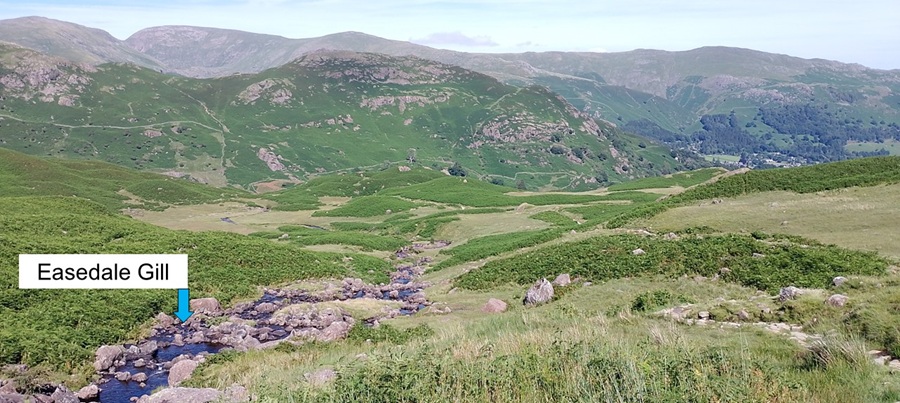
So we climbed and climbed and climbed on fairly organized stone tracks. Hopefully these stones had been laid to make life easier for the pack animals (not the tourists). Still, it was quite wobbly and one needed to keep checking where to put one's feet. We thought we would just hike to the top and the lake was there. We were wrong. Our hike kept taking us along Easedale Gill - seemingly endlessly sloping up the fell. |
|||||||||||||||||||||||||||||||||||||||||||||||||||||||||||||||
|
|||||||||||||||||||||||||||||||||||||||||||||||||||||||||||||||
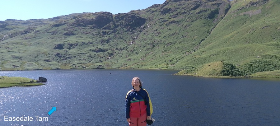
| Finally, we got to the top. We were rewarded with a lovely view of the tarn. Well-worth the slog. | |||||||||||||||||||||||||||||||||||||||||||||||||||||||||||||||
|
|||||||||||||||||||||||||||||||||||||||||||||||||||||||||||||||
|
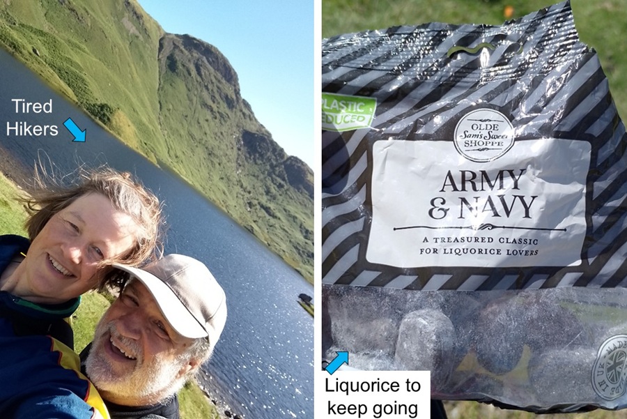
It was a beautiful sunny day and we had a rest while others were more energetic
and went for swims. It wasn't very busy yet because school holidays have not
started yet.
With a diminishing supply of water in our bottles, we enjoyed some classic Army&Navy liquorice candy. |
|||||||||||||||||||||||||||||||||||||||||||||||||||||||||||||||
|
|||||||||||||||||||||||||||||||||||||||||||||||||||||||||||||||
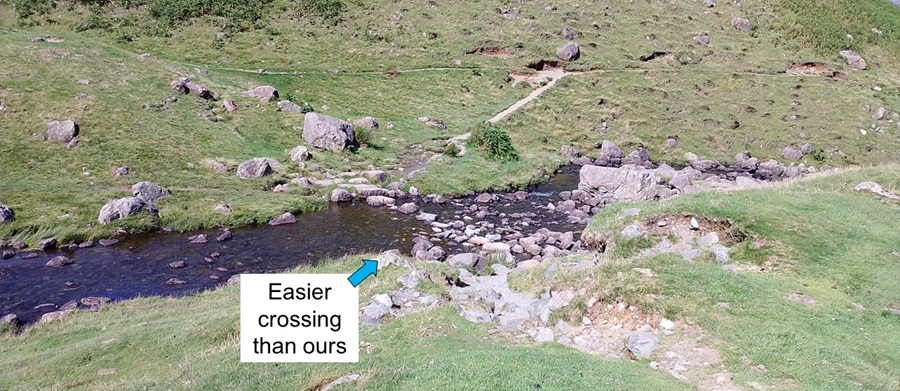
| As we turned around to go back down the fell, we noticed how the gill-crossing here is much easier than what we faced down by the missing bridge. | |||||||||||||||||||||||||||||||||||||||||||||||||||||||||||||||
|
|||||||||||||||||||||||||||||||||||||||||||||||||||||||||||||||
| Today's paths went from easy gravel tracks, to wobbly stone tracks, to potential-ankle-twisting stone trails, to bracken-covered trails. We do like variety. | |||||||||||||||||||||||||||||||||||||||||||||||||||||||||||||||
|
|||||||||||||||||||||||||||||||||||||||||||||||||||||||||||||||
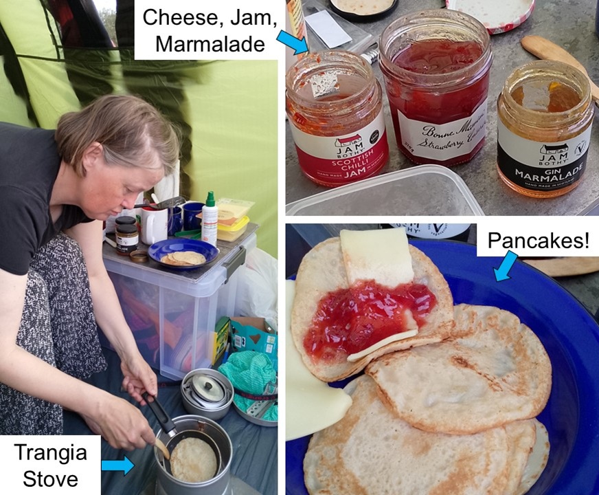
| The hike back to Percy was easier (no navigation needed) and quicker (downhill). We rushed back home to the tent and made pancakes for dinner. The Trangia stove did not disappoint. Cheese and a selection of jams and marmalade were on offer. Luxury! | |||||||||||||||||||||||||||||||||||||||||||||||||||||||||||||||
|
|||||||||||||||||||||||||||||||||||||||||||||||||||||||||||||||
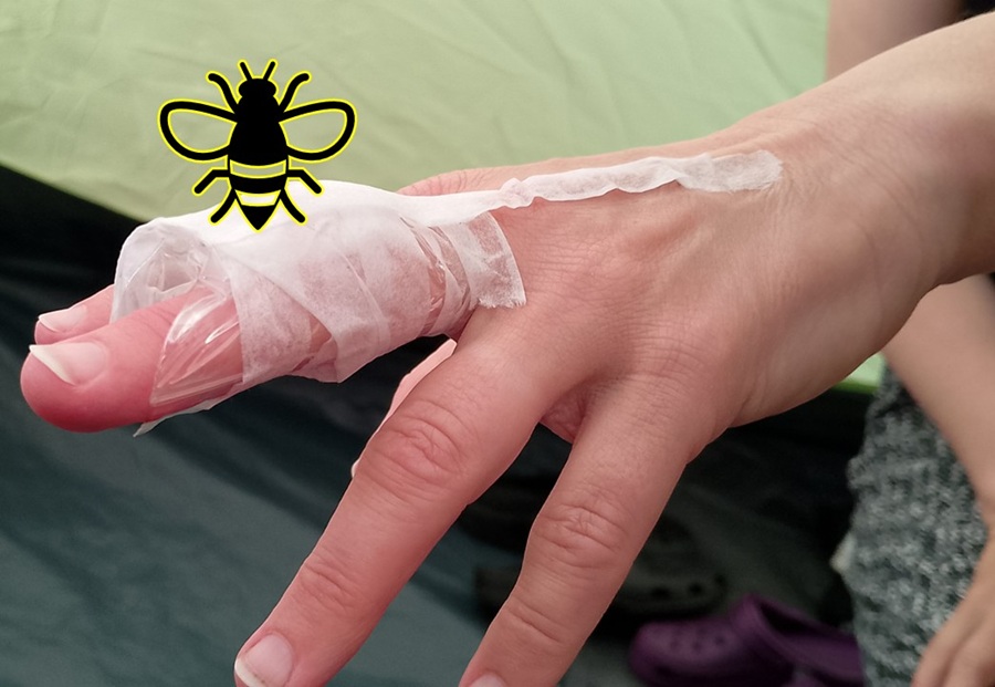
| Just as we were closing up the tent to get some work done, tragedy hit. Hild was stung by an angry (is there any other kind?) wasp while closing the tent door. Quick action with homemade ice-pack seems to have done the trick. It was difficult - but not impossible - to operate a keyboard with this ice-pack! | |||||||||||||||||||||||||||||||||||||||||||||||||||||||||||||||
|
|||||||||||||||||||||||||||||||||||||||||||||||||||||||||||||||
| Coming up: Day of work at Mains Farm. | |||||||||||||||||||||||||||||||||||||||||||||||||||||||||||||||
Start
| To Previous Day
| To Next Day
| Nerdy
| Stranger Things
| Stairs Stairs Stairs
May-July 2025
May-July 2025