
Rob-n-Hild Take the High Road!
Click links to jump to specific days:
Start | Nerdy
| Stranger Things
| Stairs Stairs Stairs
|
|||||||||||||||||||||||||||||||||||||||||||||||||||||||||||||||
|
Northern Shetland |
|||||||||||||||||||||||||||||||||||||||||||||||||||||||||||||||
|
It was another blustery day and the Isle of Noss ferry was not running. Our plan
A was to explore the North West of the mainland. We went north to Roe, west to
Eshaness Lighthouse, and west to Sandness/Melby. There was a lot of single-track
driving with many sheep and lambs in the road: so a slowish drive today.
We drove 213 km in 5 hours with max altitude�129 metres. |
|||||||||||||||||||||||||||||||||||||||||||||||||||||||||||||||
|
|||||||||||||||||||||||||||||||||||||||||||||||||||||||||||||||
|
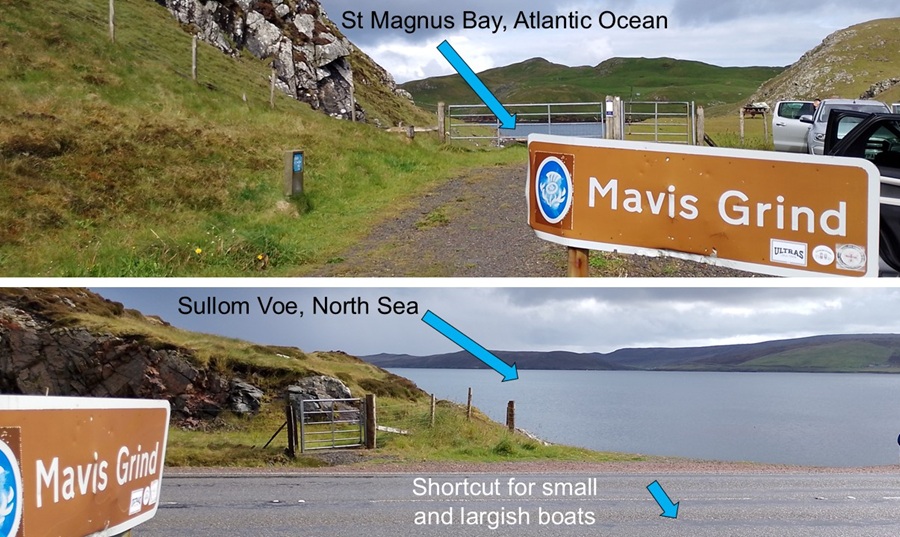
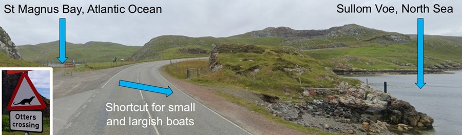
First stop was at Mavis Grind where the Atlantic Ocean and the North Sea
almost meet. As kids we used to stop here for photos. The narrow isthmus
has been used as a shortcut for carrying small boats across. That way
they avoid sailing across treacherous waters further north.
It is also a crossing that otters use. Sadly we didn't see otters, but we did see a seal. |
|||||||||||||||||||||||||||||||||||||||||||||||||||||||||||||||
|
|||||||||||||||||||||||||||||||||||||||||||||||||||||||||||||||
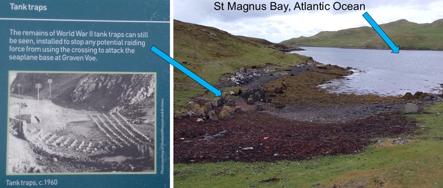
| On the St Magnus Bay side of the isthmus one can still see cement tank traps from the Second World War. They were installed to stop tanks from getting onshore. | |||||||||||||||||||||||||||||||||||||||||||||||||||||||||||||||
|
|||||||||||||||||||||||||||||||||||||||||||||||||||||||||||||||
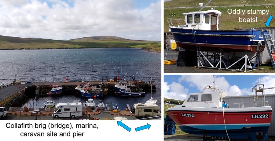
| We stopped for a toilet visit at Collafirth brig (bridge), marina, caravan site and pier. There was a donation box for those who use the facilities. So far we find that there are plenty of public toilets around the island. That helps us tourists alot - and it keeps the environment free from human waste. When you've got to go, you've got to go! | |||||||||||||||||||||||||||||||||||||||||||||||||||||||||||||||
|
|||||||||||||||||||||||||||||||||||||||||||||||||||||||||||||||
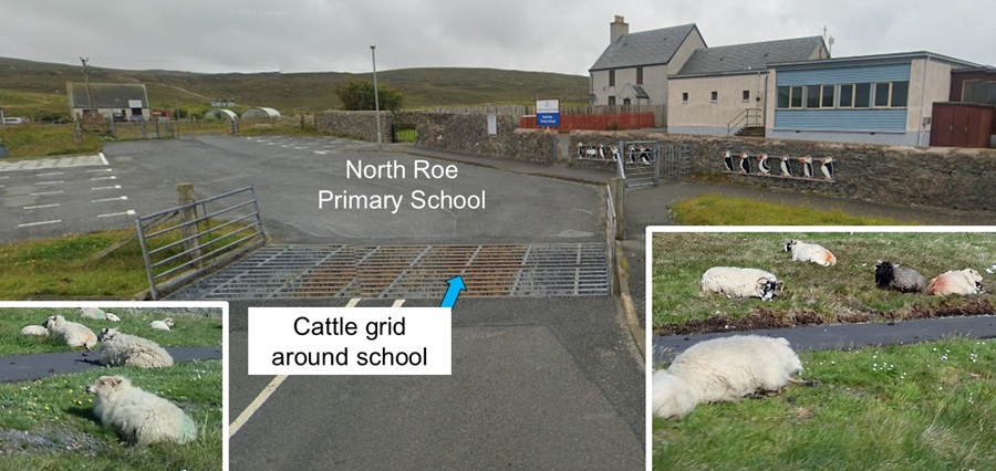
| In North Roe we drove past a primary school that had to have a cattle grid to keep sheep out. And the sheep were lying in wait outside! | |||||||||||||||||||||||||||||||||||||||||||||||||||||||||||||||
|
|||||||||||||||||||||||||||||||||||||||||||||||||||||||||||||||
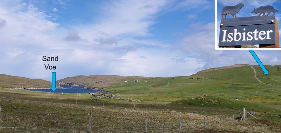
| We drove to the end of the road at Isbister farm. If we had more energy today, we could have hiked all the way to Fethaland lighthouse and the ruins of Fethaland Haaf (deep sea fishing) Station. | |||||||||||||||||||||||||||||||||||||||||||||||||||||||||||||||
|
|||||||||||||||||||||||||||||||||||||||||||||||||||||||||||||||
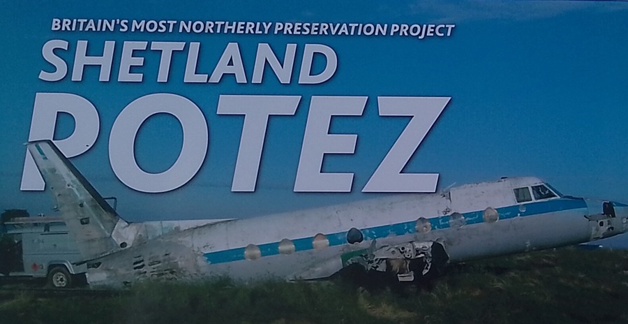
| A local man at North Roe has rescued the fusilage of a POTEZ 840 that crash landed in 1980. All passengers and crew survived but the plane could not be salvaged. We did not go up to the farm to have a look at it. A puzzling tourist attraction to find in rural Shetland! | |||||||||||||||||||||||||||||||||||||||||||||||||||||||||||||||
|
|||||||||||||||||||||||||||||||||||||||||||||||||||||||||||||||
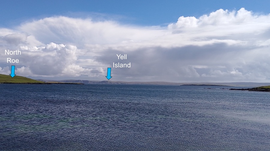
| From North Roe we could see Yell Island. | |||||||||||||||||||||||||||||||||||||||||||||||||||||||||||||||
|
|||||||||||||||||||||||||||||||||||||||||||||||||||||||||||||||
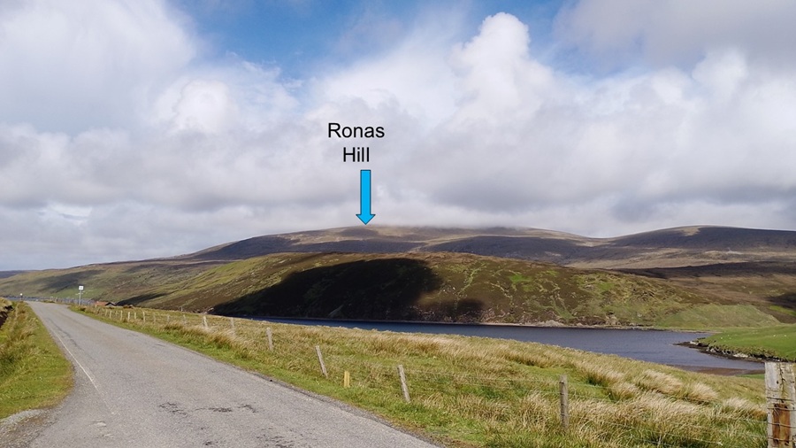
| We had a small plan to park Percy and hike up to the top of Ronas Hill. It was a very windy day and intermittent rain and fog. Apparently the top of Ronas Hill has sub arctic climate and no marked tracks. So,no we kept on driving... | |||||||||||||||||||||||||||||||||||||||||||||||||||||||||||||||
|
|||||||||||||||||||||||||||||||||||||||||||||||||||||||||||||||
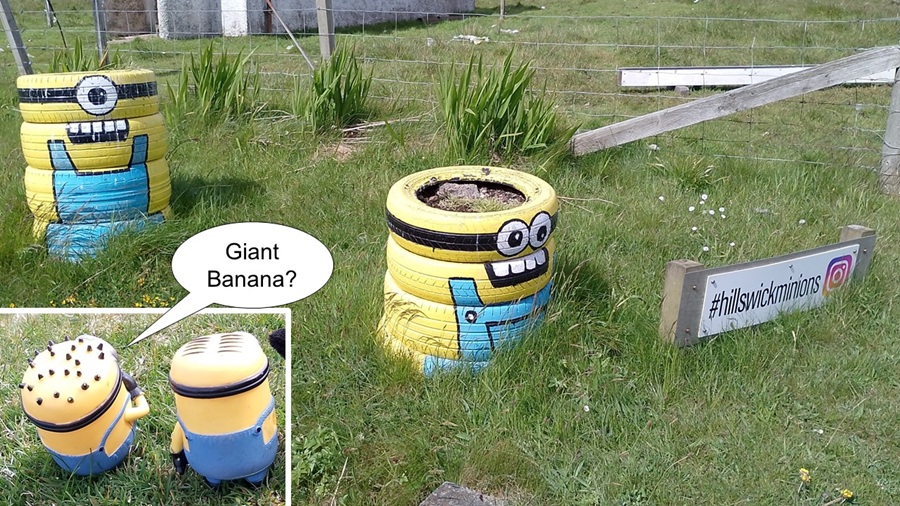
| At Hillswick we met these two fellas along the road. Our minions thought it was fun to meet others of their kind. | |||||||||||||||||||||||||||||||||||||||||||||||||||||||||||||||
|
|||||||||||||||||||||||||||||||||||||||||||||||||||||||||||||||
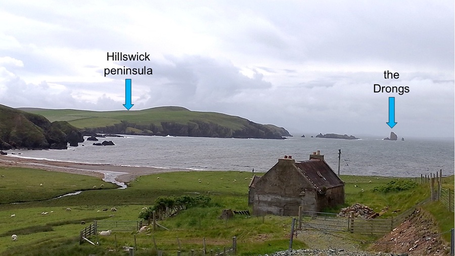
| As we drove on towards Eshaness and Stenness we caught this lovely view back onto Hillswick Peninsula and the much photographed sharp rocks, the Drongs. | |||||||||||||||||||||||||||||||||||||||||||||||||||||||||||||||
|
|||||||||||||||||||||||||||||||||||||||||||||||||||||||||||||||
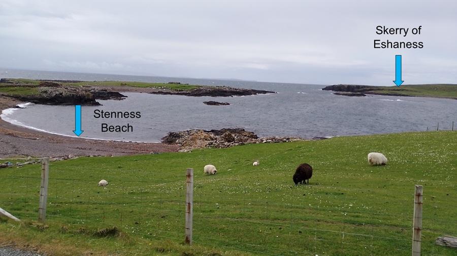
| At the end of the road we stopped at Stenness beach. There were sheep grazing with a lovely but blustery view of Skerry of Eshaness. There were also information plaques teaching us about the volcanic rocks in this area of Shetland. | |||||||||||||||||||||||||||||||||||||||||||||||||||||||||||||||
|
|||||||||||||||||||||||||||||||||||||||||||||||||||||||||||||||
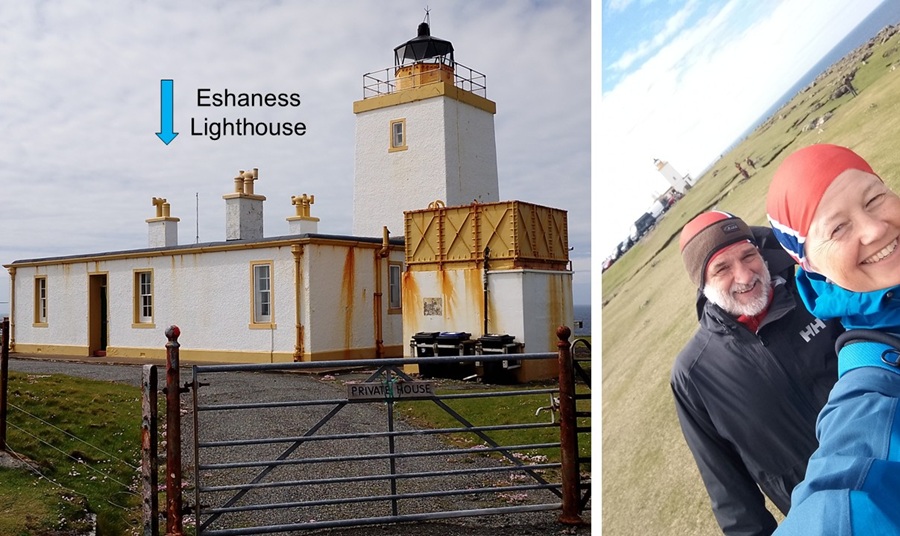
| We noticed several tour busses heading toward Eshaness Lighthouse, so we followed. We found a rather rundown lighthouse that sometimes is used as a private let. It was time for some lunch - sheltering in Percy while discussing whether to go for a hike. | |||||||||||||||||||||||||||||||||||||||||||||||||||||||||||||||
|
|||||||||||||||||||||||||||||||||||||||||||||||||||||||||||||||
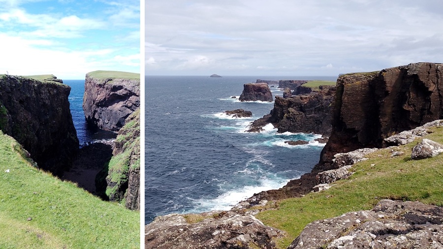
| The cliffs of volcanic rocks at Eshaness are an impressive sight, so we decided to go for that hike. | |||||||||||||||||||||||||||||||||||||||||||||||||||||||||||||||
|
|||||||||||||||||||||||||||||||||||||||||||||||||||||||||||||||
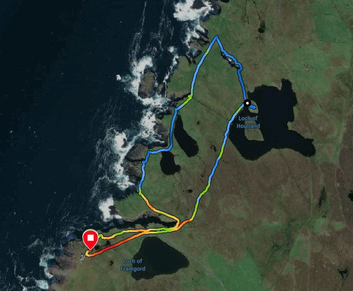
| We did a hike from Eshaness Lighthouse. Total distance was 3.41 km and we did that in 58 min - 41 min of this was walking because there was plenty of fun things to take photos of. The hike went up and down along the cliffs with a total of 134 metres ascending. However, we never got any higher than 48 meters above sea level. | |||||||||||||||||||||||||||||||||||||||||||||||||||||||||||||||
|
|||||||||||||||||||||||||||||||||||||||||||||||||||||||||||||||
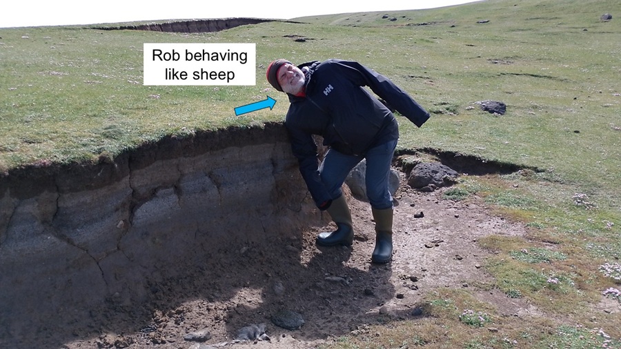
| Rob decided to emulate the many sheep we have crossed paths with on the moors: They love to use these ditches to scratch up against when they have an itch or five. Nice! | |||||||||||||||||||||||||||||||||||||||||||||||||||||||||||||||
|
|||||||||||||||||||||||||||||||||||||||||||||||||||||||||||||||
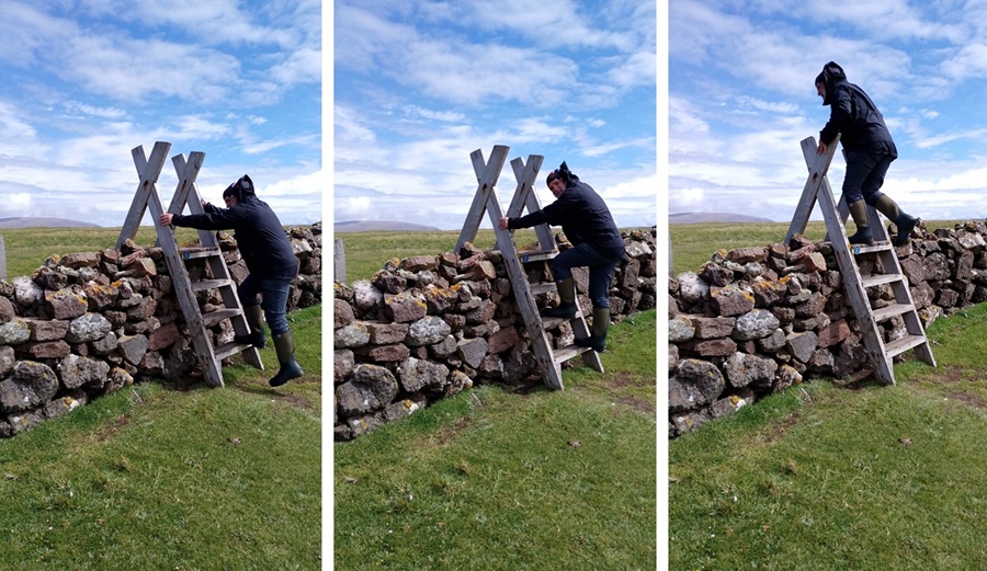
| Rob was also happy to find this fancy stile across the fence. Easy to use. | |||||||||||||||||||||||||||||||||||||||||||||||||||||||||||||||
|
|||||||||||||||||||||||||||||||||||||||||||||||||||||||||||||||
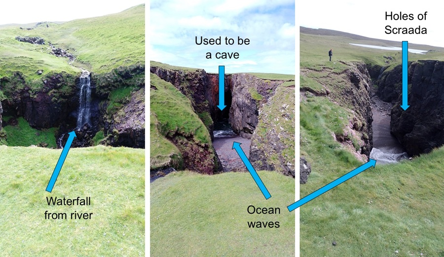
| We walked past the Holes of Scraada. This used to be a cave with entry from the sea. Then the ceiling caved in to make two holes. Finally in the 1800s the rest of the ceiling caved in - and now: one big hole. We can see a waterfall flowing in from one end, and sea waves breaking on the beach below - several hundred metres from the actual sea. Amazing. | |||||||||||||||||||||||||||||||||||||||||||||||||||||||||||||||
|
|||||||||||||||||||||||||||||||||||||||||||||||||||||||||||||||
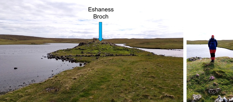
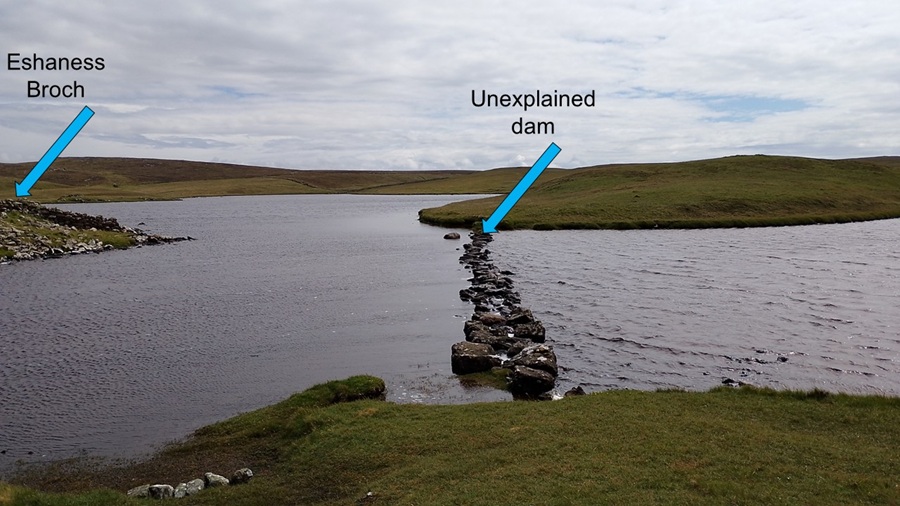
| At a lake nearby there is the 2000-year old Eshaness Broch - a structure built across Scotland during the Iron Age. This particular one lies in ruin, but we can imagine a tall building without windows - used also to defend against attack. | |||||||||||||||||||||||||||||||||||||||||||||||||||||||||||||||
|
|||||||||||||||||||||||||||||||||||||||||||||||||||||||||||||||
| We would like to know more about this dam or weir across the lake, but none of the information plaques were helpful on that matter. | |||||||||||||||||||||||||||||||||||||||||||||||||||||||||||||||
|
|||||||||||||||||||||||||||||||||||||||||||||||||||||||||||||||
|
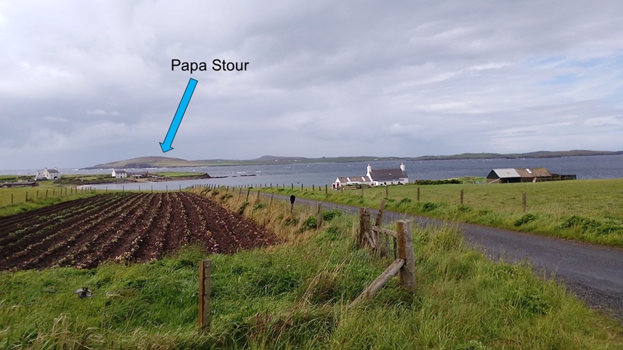
Then we drove across more moors - single track and many sheep and lambs -
to Sandness. Hild rembembers visiting here before. Back then she saw
many more Shetland Ponies than today. A shame, but such is life.
Another break was had at Melby just past Sandness. We could see across the waters to the island of Papa Stour. |
|||||||||||||||||||||||||||||||||||||||||||||||||||||||||||||||
|
|||||||||||||||||||||||||||||||||||||||||||||||||||||||||||||||
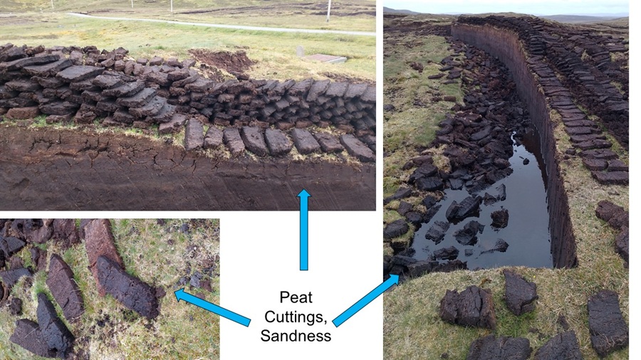
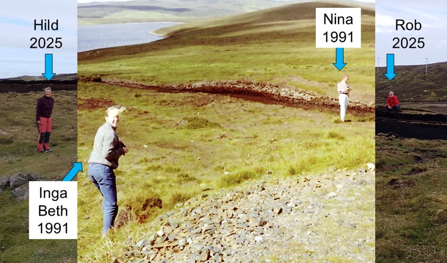
| We stopped along the road to study some peat cuttings, and to recreate a photo from 1991 when Hild was visiting with Inga Beth and Nina. Fun | |||||||||||||||||||||||||||||||||||||||||||||||||||||||||||||||
|
|||||||||||||||||||||||||||||||||||||||||||||||||||||||||||||||
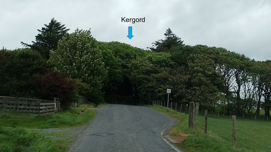
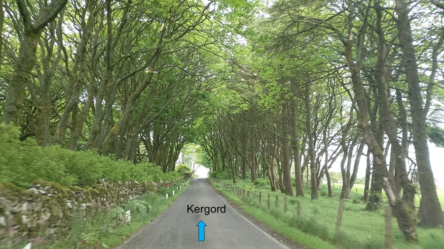
| A usual stop for photos is Kergord, where Norwegian resistance people were hiding/living during the Second World War. They liked it because it was the only place with real forest on Shetland. Amazing, real "kissing" trees on Shetland! Another fun day on Shetland. | |||||||||||||||||||||||||||||||||||||||||||||||||||||||||||||||
|
|||||||||||||||||||||||||||||||||||||||||||||||||||||||||||||||
| Coming up: Southern Shetland | |||||||||||||||||||||||||||||||||||||||||||||||||||||||||||||||
Start
| To Previous Day
| To Next Day
| Nerdy
| Stranger Things
| Stairs Stairs Stairs
May-July 2025
May-July 2025